 |
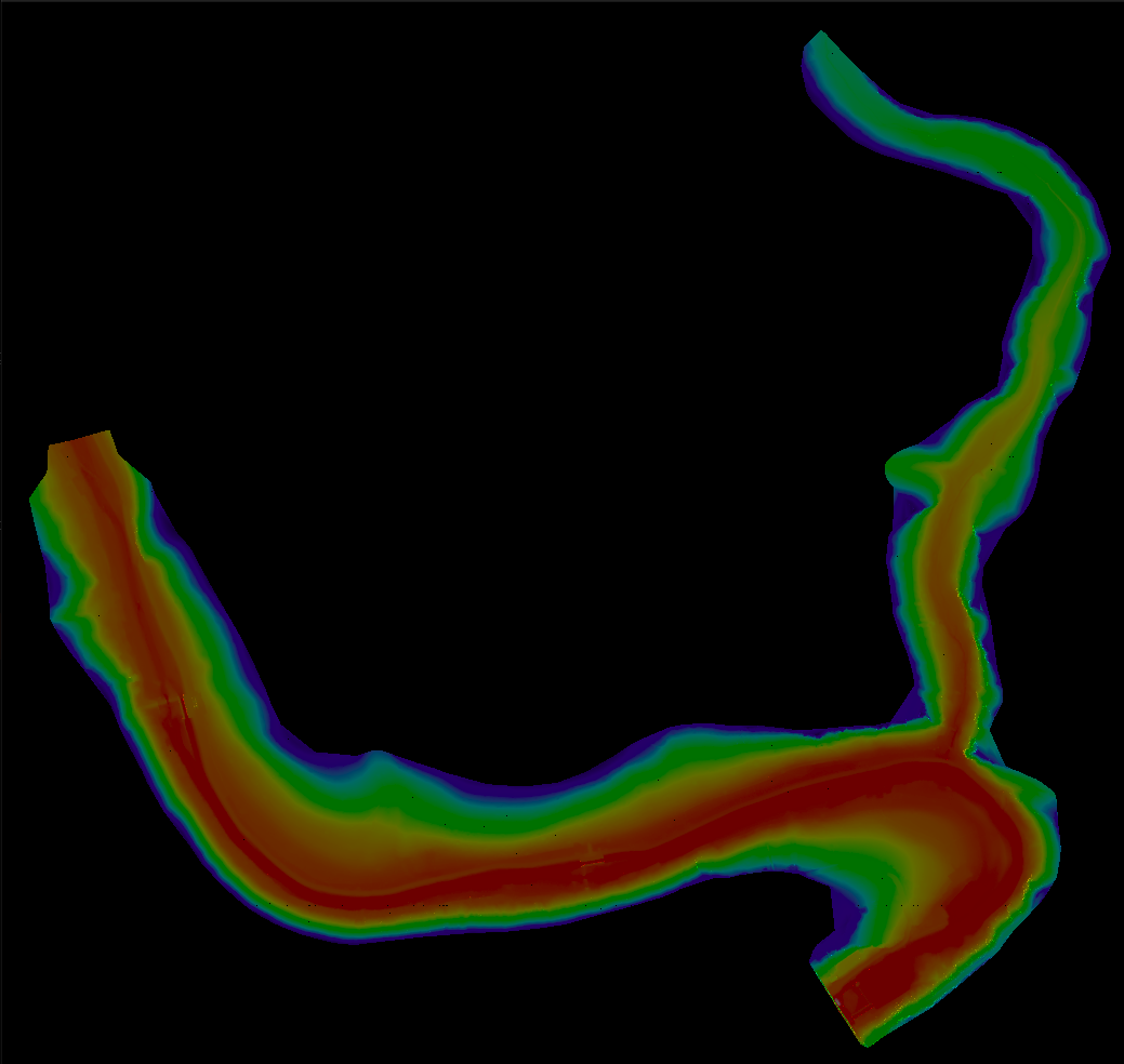
Terrain Rasterizer
Conversion of GPS data into 2.5D topographic maps
|
|
Terrain Rasterizer
Conversion of GPS data into 2.5D topographic maps
|
Represents a 2D axis-aligned bounding box. More...
#include <quadtree.hpp>
Public Member Functions | |
| bool | contains (double x, double y) const |
| Checks if a point is within the bounding box. | |
| bool | intersects (const BoundingBox &other) const |
| Checks if this bounding box intersects with another. | |
Public Attributes | |
| double | minX |
| double | minY |
| double | maxX |
| double | maxY |
Represents a 2D axis-aligned bounding box.
| bool BoundingBox::contains | ( | double | x, |
| double | y | ||
| ) | const |
Checks if a point is within the bounding box.
| x | X coordinate of the point. |
| y | Y coordinate of the point. |
| bool BoundingBox::intersects | ( | const BoundingBox & | other | ) | const |
Checks if this bounding box intersects with another.
| other | The other bounding box. |